


 34 / 111

33
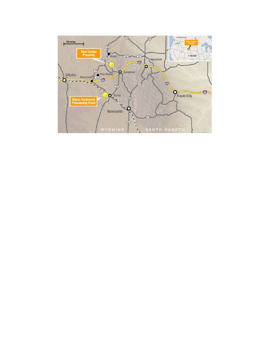
Bear Lodge Property – Location Map
Geological Setting
The Bear Lodge Mountains of northeast Wyoming are composed primarily of the upper levels of a
mineralized Tertiary alkaline
‐
igneous complex that is a component of the Black Hills Uplift of western South
Dakota and northeast Wyoming. Tertiary alkaline intrusive bodies in the northern Black Hills occur along a N70-
80W trending belt that extends from Bear Butte in South Dakota, through the Bear Lodge Mountains, to Devil’s
Tower and Missouri Buttes in northeast Wyoming. The Bear Lodge mining district is in the Bear Lodge Mountains,
near the western end of the northern Black Hills intrusive belt. The Bear Lodge Mountains expose and are underlain
by multiple alkaline plugs, sills, and dikes and intruded into Precambrian basement and Paleozoic and Mesozoic
sedimentary rocks approximately 38–52 million years ago. Rare earth and gold mineralization are found in separate
areas of the central crest and northern part of the Bear Lodge Mountains.
The Bear Lodge alkaline-igneous complex is a northwest-trending alkaline intrusive dome with dimensions
of approximately 10 kilometers NW-SE by 6 kilometers NE-SW. The complex consists predominantly of multiple
intrusions of phonolite, trachyte, and other alkaline igneous rocks, and a variety of associated breccias and
diatremes.
Exploration and Drilling
Historical exploration in the Bear Lodge district, including REE exploration carried out by the Company
from 2004 through 2012, is summarized in the Technical Report.. Exploration activities carried out by the Company
in 2013 through 2015 were limited as the focus turned to development drilling at the Bull Hill and Whitetail Ridge
deposits. These exploration activities included geochemical, geophysical, geological and mineralogical modeling of
the district and individual deposits.
The 2013 drilling program was conducted in two phases. The first phase took place in June and July and
involved infill drilling at the Whitetail Ridge deposit in order to upgrade a significant portion of the resource from
the Inferred Mineral Resource category to the Indicated Mineral Resource category. During this phase, 14 core holes
were drilled for a total of 3,556.3 meters (11,697.5 feet). The second phase was designed to upgrade part of the
high-grade resource at the Bull Hill deposit to the Measured Mineral Resource category, develop a more detailed
model of the REE grade distribution and provide additional material for bulk metallurgical testing. It consisted of
21 core holes totaling 3,247.1 meters (10,650.5 feet) and six reverse circulation (“RC”) twin holes totaling 832.3
meters (2,730 feet). The RC twin holes were drilled using a center return hammer with the objective of minimizing
hole erosion and obtaining assay data directly correlative to that from the adjacent core holes.